
|
 Siachen – “Place of Wild Roses” Siachen – “Place of Wild Roses”
Why search elsewhere? |
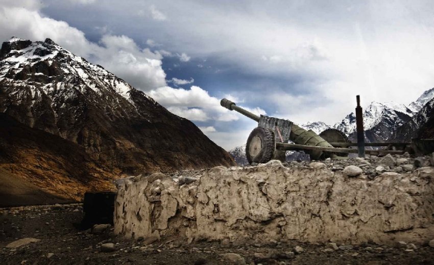
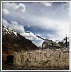
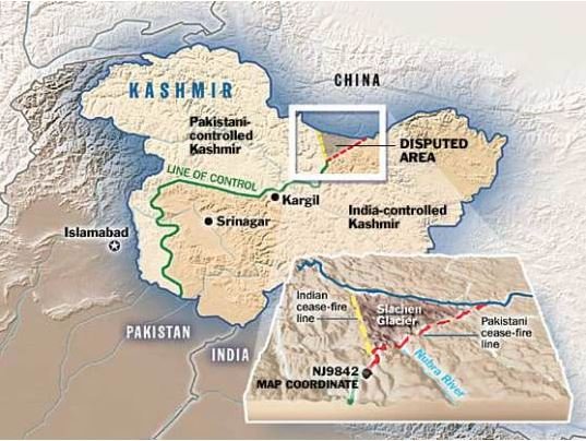
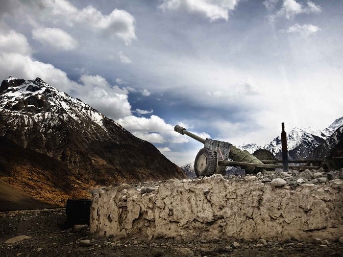
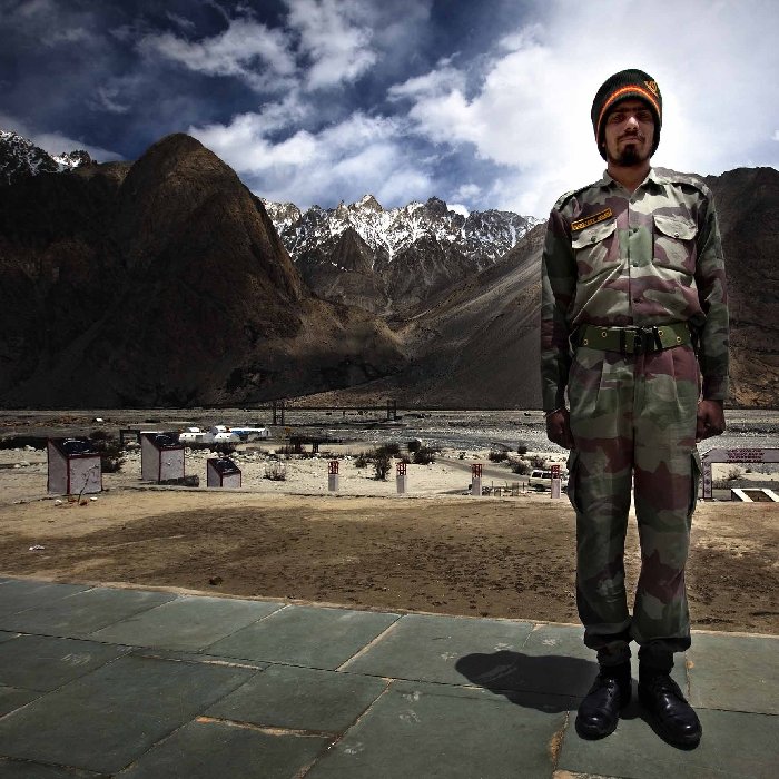
Descending from 19,000 feet to 12,000 feet, over a length of 70 km, Siachen glacier (“place of wild roses”) is the worlds highest battleground since the year 1984. India controls its entire glacial length, adjoining peaks and the three passes, which are the gateway between Karakoram and Ladakh. On the other hand, Pakistan controls its western glacial valley. It is estimated that the two nations, collectively have over 6,000 soldiers stationed at these formidable heights, manning over 150 posts, costing over US$500m annually. The military stand off leaves no scope for Pakistanis to ascend or for Indians to descend.
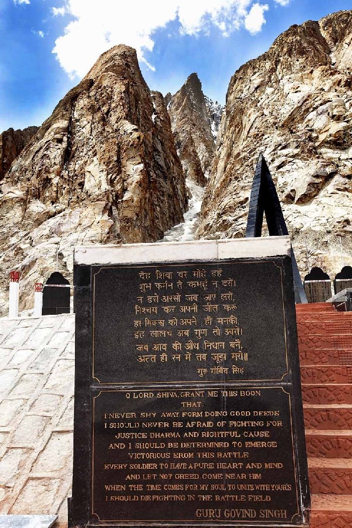
The Sikh rule in Kashmir lasted from 1819 AD till 1846 AD and in Baltistan from 1832 AD till 1846 AD. Though the rule in the Karakoram region had a short window but it changed the course of its history. Ranjit Singh was a liberal ruler, in whose cabinet there was a representation in high posts from both Hindu and Muslim community. His Prime Minister was Dhian Singh, the Dogra Hindu King of Jammu, whom he trusted the most. Dhian Singh’s brother, Gulab Singh, a Dogra Hindu was a commander in Ranjit Singh’s army. After the demise of Ranjit Singh in 1839 AD, Gulab Singh deceived the Sikh kingdom by secretly joining hands with British to cut off the military supplies to Sikh army fighting the British at river Sutlej in 1846 AD. In exchange, for helping win over Sikhs, Gulab Singh Dogra was awarded an independent title of Kashmir and Baltistan by the British. The Sikh kingdom was thereafter annexed into British India empire in the year 1846 AD. Reflecting back, Maharajah Ranjit Singh’s victory over Kashmir and Ladakh in 1819 AD and Baltistan in 1832 AD is the reason why these territories found a place in the map of British India. Thereafter during independence of India in 1947 AD, the entire region of Kashmir and Baltistan became disputed between Pakistan and India, leading to the current military fiasco in the Karakoram range. If not for the Sikh conquest, this region would today have been involved in Afghanistan’s political issues. While the contribution of Sikhs in forming the modern history of this region is now a less known fact but the annals of history are well aware of the sacrifices made by the Sikh army, under Maharajah Ranjit Singh, in these formidable Karakoram region. At the war memorial in Siachen Glacier, I was pleased to find a plaque reflecting the verses of Guru Gobind Singh, the 10th Sikh Guru. A reminder to the soldiers of the Sikh Light Infantry that the righteousness of life is to be privileged to die in the battle field.
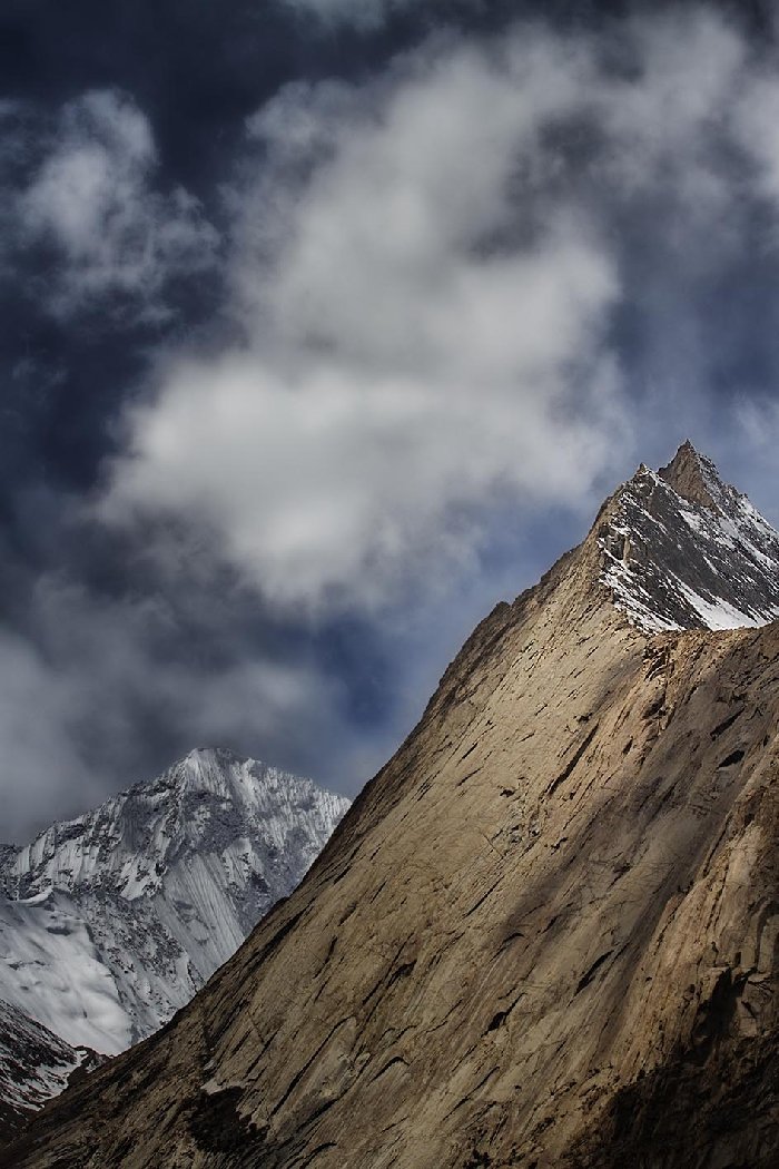
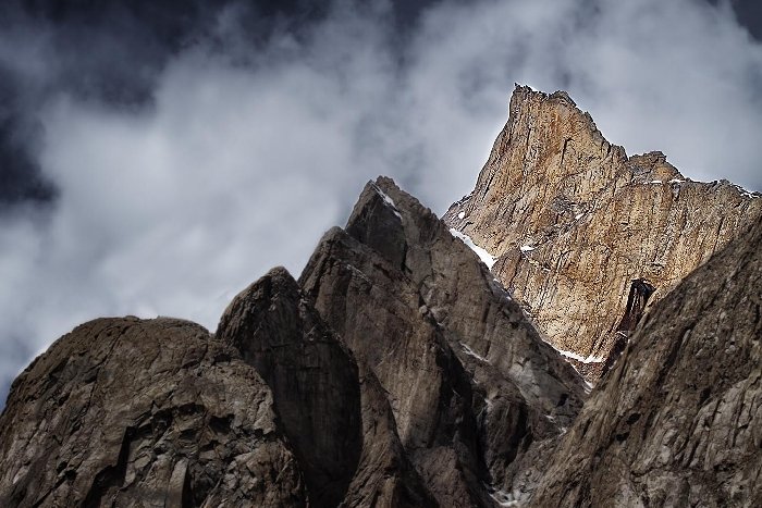
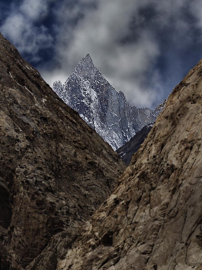
The most impressionable sight during this journey were the shape of mountains along the Nubra river. This part of the Karakoram mountain range, I believe is the worlds steepest, with hills rising literally ninety degrees to the ground, converging into pin-pointed peaks. When I say “pin-pointed”, believe me the top of these peaks offer stiff competition to the sharpness of man made pin tips. In this isolated region, the power of perception and connection takes a quantum leap. As I tried to photograph the Creators magnificence in these strange peak formations, I was reminded of the verse by Saint Kabir from Adi Granth, which I have mentioned at the start of this post.
This article is an update from a previous article of the same title. |

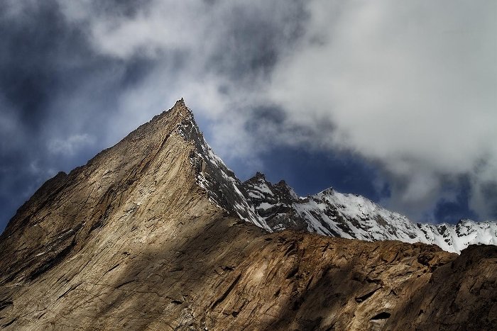
 Pointed peaks of Karakoram range.
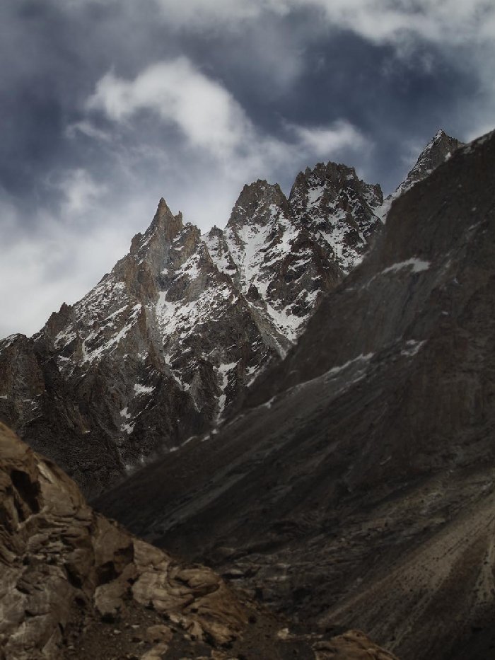
 Pointed peaks of Karakoram range.